
In a mission fueled by both privacy concerns and personal conviction, a Huntsville-born software engineer has embarked on an ambitious project to map license plate reader (LPR) devices across the United States. His goal? To shed light on the growing presence of surveillance technology in public spaces and raise awareness about the potential implications for individual privacy.
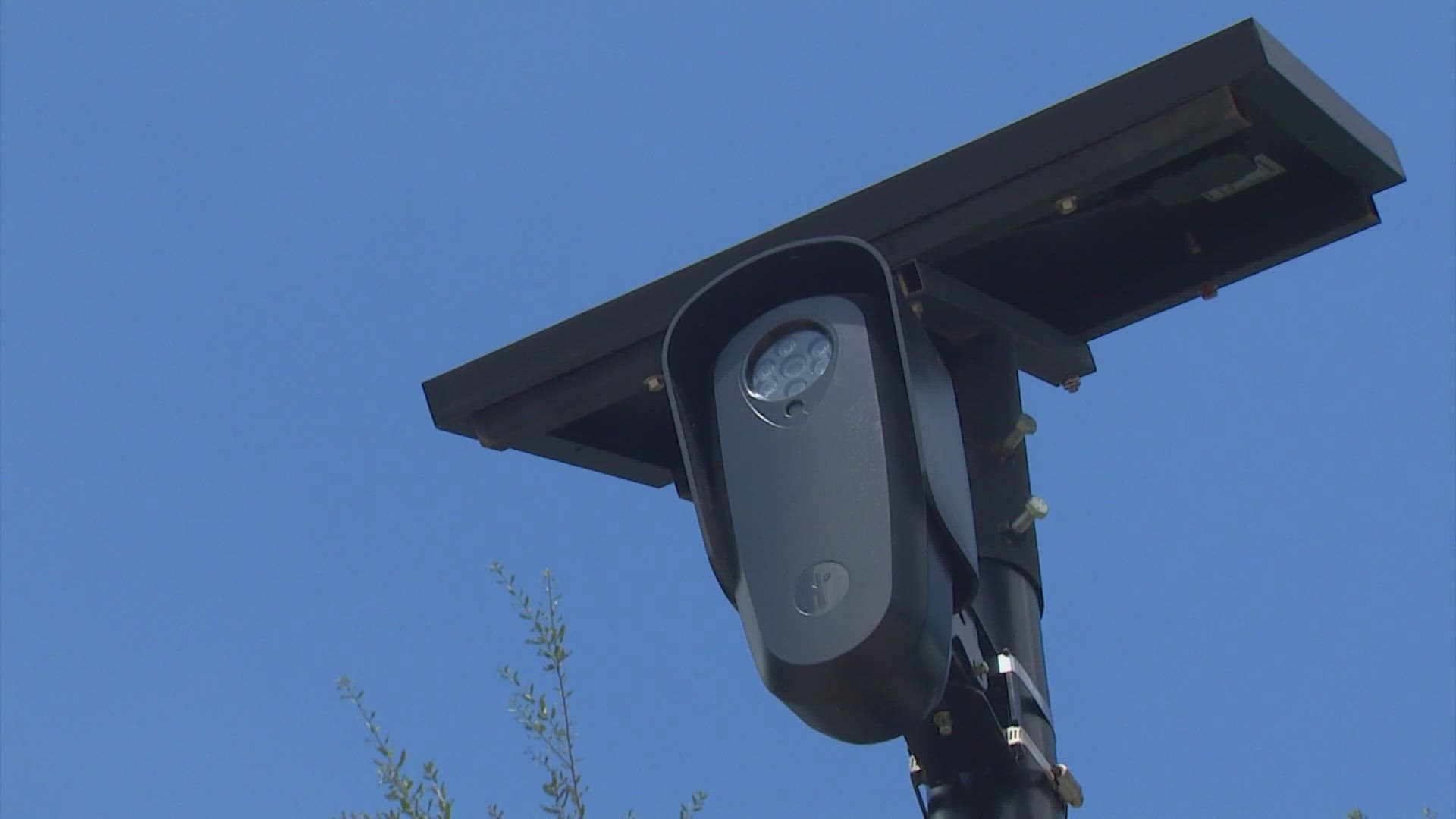
The software engineer, who wishes to remain anonymous, has spent the past two years collecting data on the location of thousands of license plate readers installed by law enforcement agencies, private businesses, and even local municipalities. These high-tech devices, capable of capturing detailed images of vehicles and their license plates, are increasingly being used to track vehicles as they move through cities, highways, and other public spaces.
“I don’t like being tracked. I don’t think anyone should be tracked without their consent,” said the engineer in an exclusive interview with The Huntsville Gazette. “License plate readers are essentially the modern equivalent of surveillance cameras, but unlike cameras that capture faces, LPRs track your every movement, your every trip, without you even knowing it.”
An Expanding Web of Surveillance
License plate readers have been around for over a decade, primarily used by law enforcement to solve crimes, track stolen vehicles, and enforce toll payments. However, in recent years, these devices have become more widespread, with more agencies and private entities installing them at intersections, parking lots, and highways. The increasing deployment of LPRs has sparked a heated debate about the balance between public safety and personal privacy.

According to the engineer, the map he’s building provides an alarming look at the ubiquity of LPRs across the country. His dataset includes information on over 10,000 devices, some of which are used by law enforcement agencies while others are installed by private entities, like shopping malls or parking facilities. The map shows a dense network of LPRs in urban centers, but also highlights more rural and remote areas where surveillance is less expected.
“Most people have no idea how much they’re being tracked. These devices are everywhere, and they’re being used for all kinds of purposes beyond what the public is told,” he explained.
The Project’s Roots in Personal Privacy Concerns
The software engineer’s interest in LPRs stems from his own concerns about surveillance and data privacy. Growing up in Huntsville, a city known for its tech industry and innovation, he became increasingly aware of how data is being collected, stored, and used by both government agencies and private companies. In particular, he was troubled by the idea that license plate data could be used to build detailed profiles of individuals without their knowledge.
“It’s not just about tracking cars. It’s about tracking people. Every time you go somewhere, every time you stop for gas, every time you go to work or school, someone is keeping a record of it,” he said.
While the software engineer’s work is grounded in technology, his message is clear: surveillance is a growing concern that needs to be addressed. By creating an accessible, publicly available map of LPR locations, he hopes to empower citizens to better understand the surveillance infrastructure in their communities and advocate for stronger privacy protections.
A Call for Regulation
The engineer’s project has sparked significant attention, especially among privacy advocates, legal experts, and government officials. Some have lauded the effort as a much-needed step in ensuring transparency and accountability when it comes to surveillance technology.
“This is a wake-up call,” said Elizabeth Blackwell, a privacy lawyer who has worked on cases involving surveillance technology. “The fact that these devices are so pervasive—and often installed without public knowledge or oversight—raises serious questions about how our data is being used and whether we have any control over it.”
Advocacy groups like the Electronic Frontier Foundation (EFF) have called for stronger regulations on the use of license plate readers, citing the risk of data misuse and potential violations of civil liberties. The group advocates for measures like data retention limits, transparency around data sharing, and clear rules about who can access LPR data.
“Right now, there’s a patchwork of regulations governing license plate readers, and too many of them lack transparency,” said EFF spokesperson Mia Patel. “The public deserves to know where these devices are and how their data is being used.”
While the software engineer’s map is still a work in progress, it has already garnered significant attention from privacy-conscious citizens, journalists, and lawmakers alike. Some have even suggested that the map could be used as a tool for advocacy, allowing individuals to pinpoint surveillance hotspots in their communities and demand greater transparency from local authorities.
For now, the engineer is focused on refining the map and gathering more data, with the hopes of expanding the project into an even more comprehensive tool. Despite facing challenges—ranging from data accuracy to potential legal hurdles—he remains determined to finish the project and continue his work advocating for privacy rights.
“My goal is simple: I want people to understand the scope of surveillance that’s happening, and I want them to realize that we still have the power to change things,” he said. “If we don’t start taking action now, it could be too late.”
As his project gains traction, the engineer’s work is poised to spark broader discussions about surveillance, data privacy, and the role of technology in shaping the future of civil liberties.


